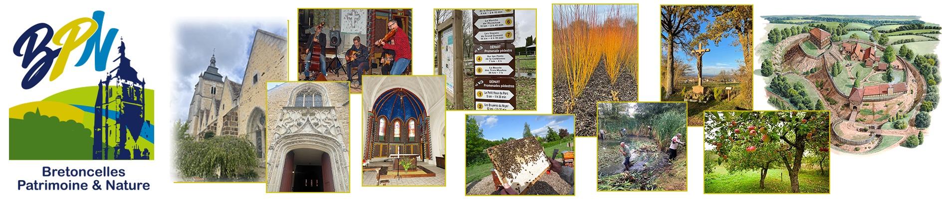
Hiking Trails (continued)

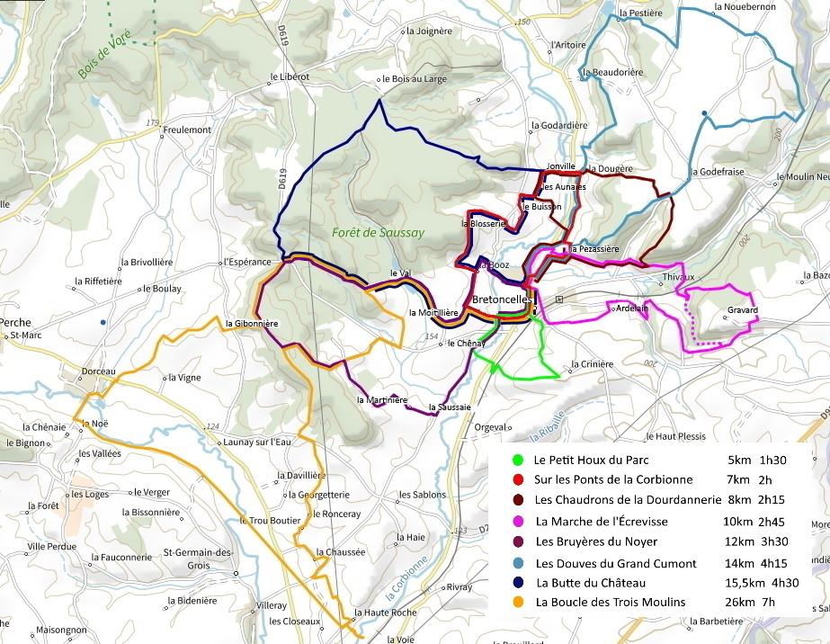
8 hiking trails around Bretoncelles

FR 

Bretoncelles is the second largest commune by area in the Perche natural park.  The some 120 hamlets and localities within its boundaries, its forests, rivers and streams and the diversity of its countryside make it an ideal area for walking.  Bretoncelles Patrimoine et Nature maintains 8 hiking trails covering around waymarked 100 kilometres all departing from the 'complexe sportif' car park (just opposite the camper van park).
There you will find an explanation panel and a QR code to find this page on your smartphone.

BPN has given poetic and evocative names to its trails:
- Le petit Houx du Parc                        (5 km) 
- Sur les ponts de la Corbionne          (7 km)
- Les chaudrons de la Dourdannerie (8 km)
- La marche de l'Écrevisse                 (10 km)
- Les bruyères du Noyer                    (12 km) 
- Les douves du Grand Cumont         (14 km)
- La butte du Château                        (15,5 km)
- La boucle des Trois Moulins           (26 km)

Way marks are regularly maintained by BPN volunteers, helped by supervisors.
The map, description, gpx file and QR codes are provided for each trail.
The village is served by rail via the SNCF station on the Paris - Le Mans line.
To reach the departure point for the trails follow the signs for the 'complexe sportif'.

The vilage has:
bakers, butcher /deli, general shop.

Accommodation:  gîtes and b&b (les Défais, la Féverole)

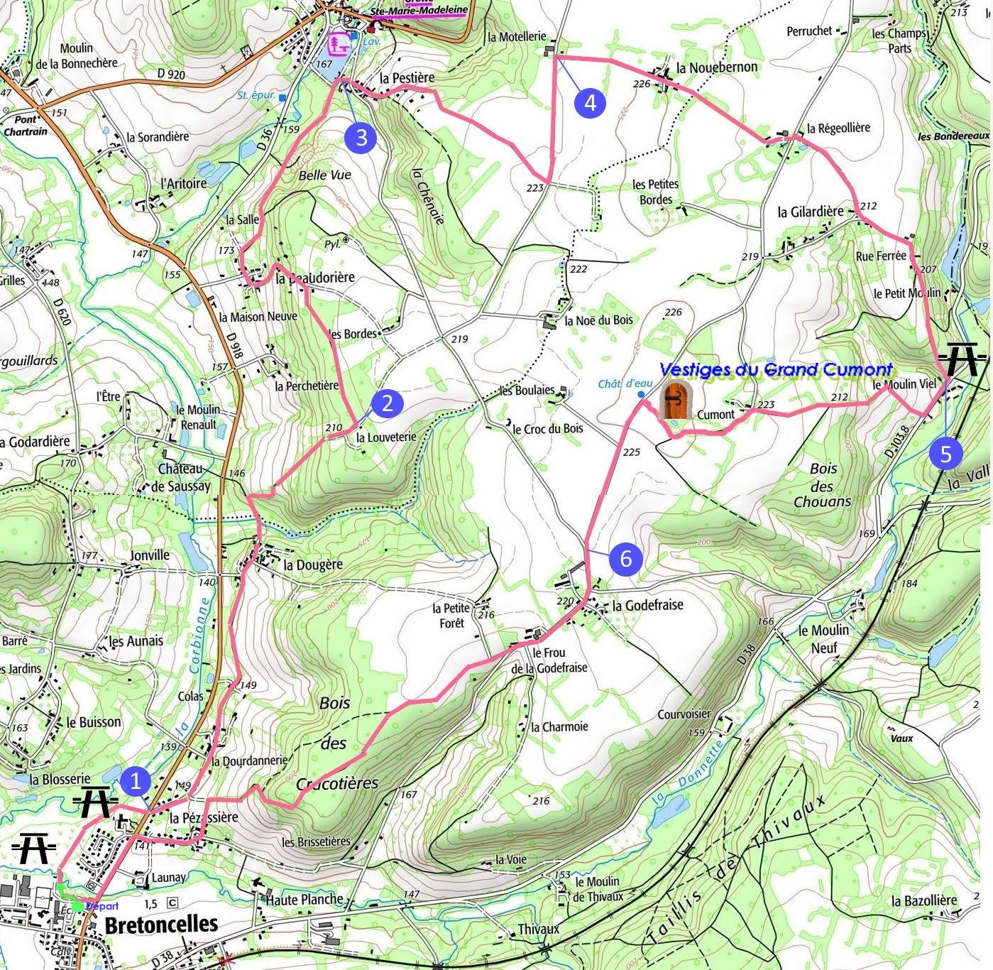
Map of the 8 hiking trails starting in Bretoncelles

Carte 8 chemins avec légende

CDC - Coeur du PercheLe ParcL'Orne en Normandie

We recognise the initial contribution of these organisations in the preparation of the documents and files published on this site.  We very much appreciate their efforts and thank them for their continued support.

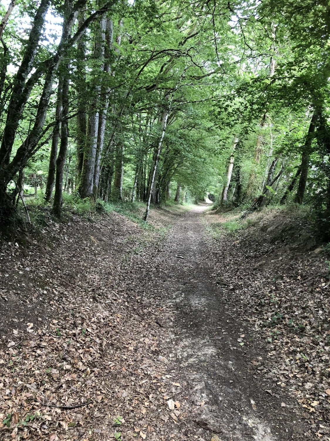
La marche offre des bienfaits pour la santé !

Giphy 1

Walking is a physical exercise advised in all cases provided you do it for 30 minutes a day.

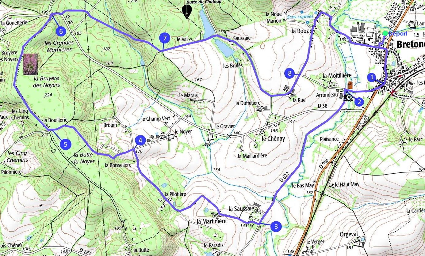
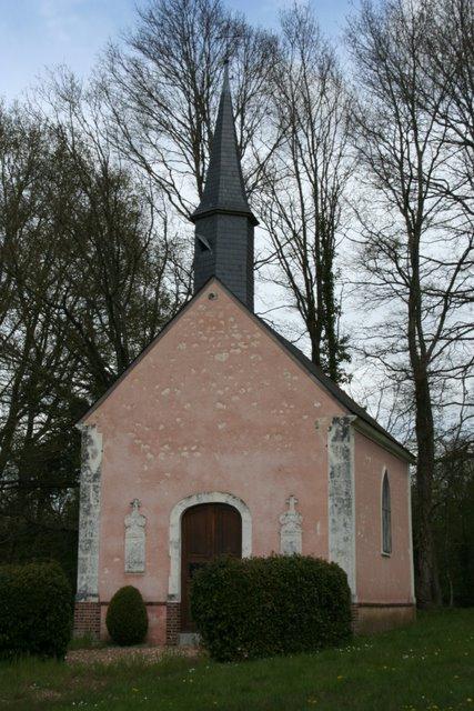
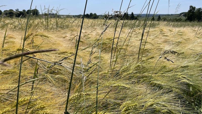
Les Bruyères du Noyer (Walnut Heath)

Distance and time: 12 km (3 hours 30)

To discover:
♦ Heather : heather prefers well-drained acid soil and a sunny exposition. It flourishes on the walnut tree covered hilltops on the sandy soils of the Saussay forest.  Flowering between July and September it carpets large areas of the moorland and clearings.
♦ Le Noyer, signeurial fiefdom : this simple squire's dwelling from the 16th century was supposedly built by Louis du Chemin, squire and lawyer who collected the taxes of the seneschal of Nocé and the bailiff of Moutiers and Villeray.  Le Noyer is nowadays a farm whose distinguishing feature is its tower with a conical roof.  Its heel-shaped cornice seems to match the date of building of Petit Courboyer in Sainte-Gauburge-de-la-Coudre, whose tower dates from 1592.

Bruyeres du noyer 2

Les Bruyères du Noyer

Les Bruyères du Noyer
12 km - 3 hours 30
Departure : Bretoncelles, car park of the 'Complexe Sportif'.
Direction : clockwise
Waymarking: (PR) yellow signposts and way marks
Terrain : dirt and stony paths and narrow tarmac lanes (73%).
Points of interest : pleasant forest walk and typical Perche houses.

Useful links:

  1. Route here;
  2. Map here;
  3. GPX file here.

Les bruyeres carte 1

        QR code map

Qr en bruyeres itin        QR code route


On the way... :

You will find heather,

and you will pass le Noyer, seigneurial fiefdom.

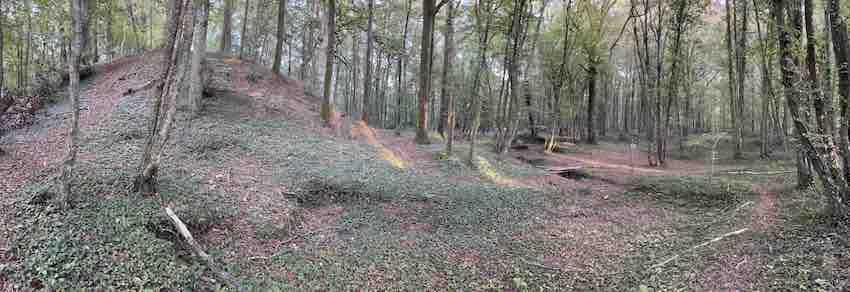
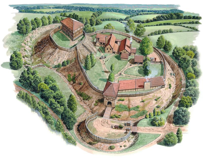
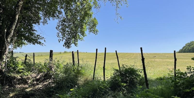
Les Douves du Grand Cumont (The Moat of Grand Cumont)

Distance and time: 14 km (4 hours 15)

To discover :
♦ The natural conservation area (l’Espace Naturel Sensible (vallées et marais de Bretoncelles));
♦ The old bread oven at la Dougère;
♦ The pond at la Godefraise, maintained every year by BPN volunteers;
♦ La Régeolière and its calvary cross;
♦ The remains of the Grand Cumont.

Les Douves du Grand Cumont

Apres travaux

Useful links:

  1. Route here:
  2. Map here;
  3. GPX file here.

Les douves carte qr          QR code map

Qr en douves itin          QR code route

Departure : Bretoncelles, car park of the 'Complexe Sportif'.
Direction : clockwise.
Waymarking : (PR) yellow signposts and way marks.
Ease of walking: quite good (steep incline, some wet sections).
Terrain : dirt or stony paths, some tarmac road).
Points of interest : panoramic views, remains of Grand Cumont.

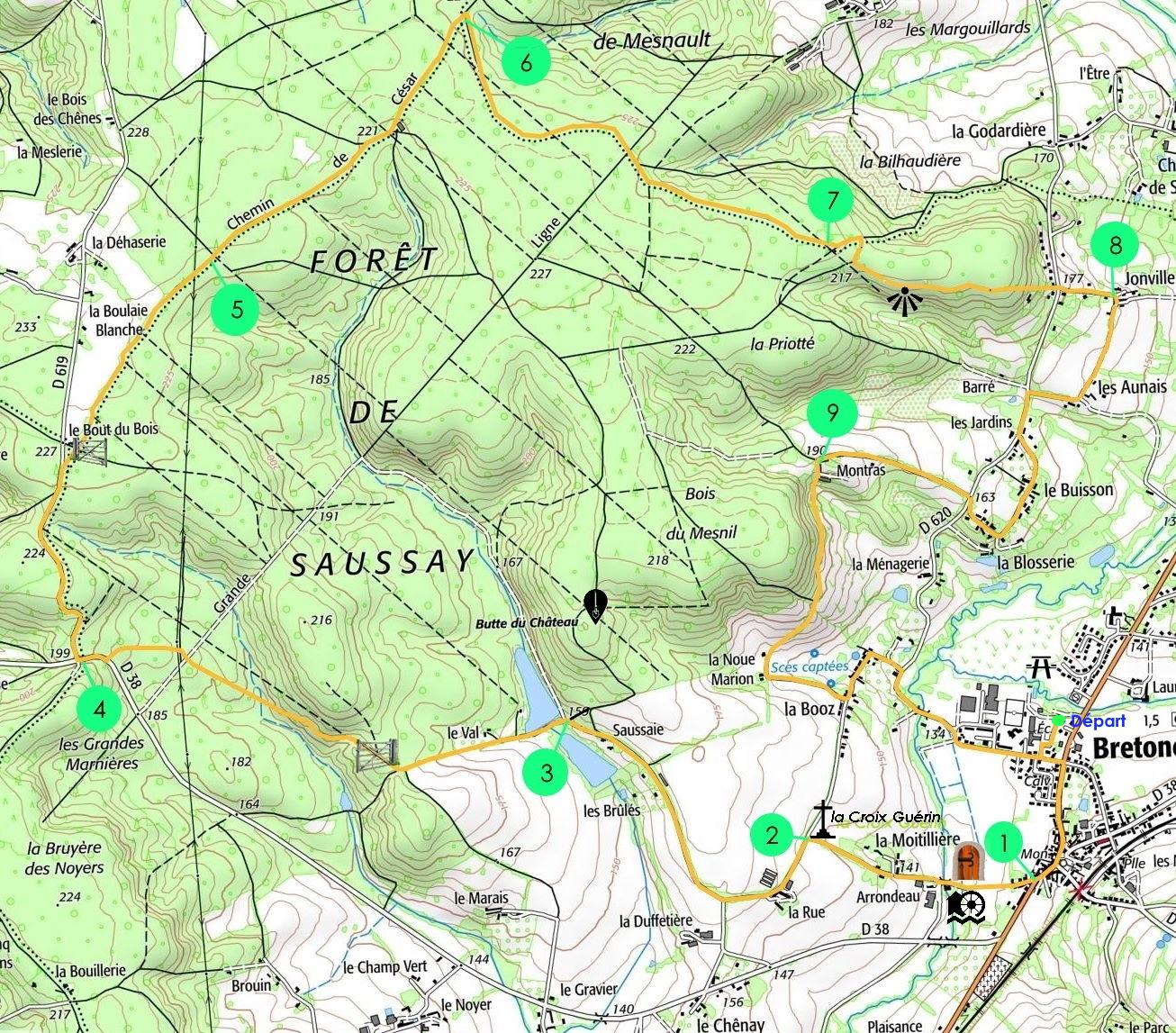
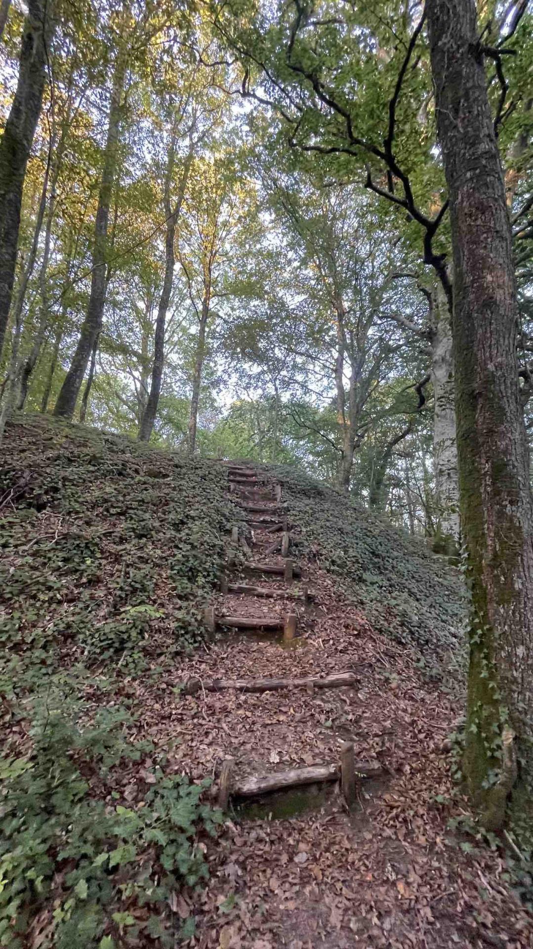
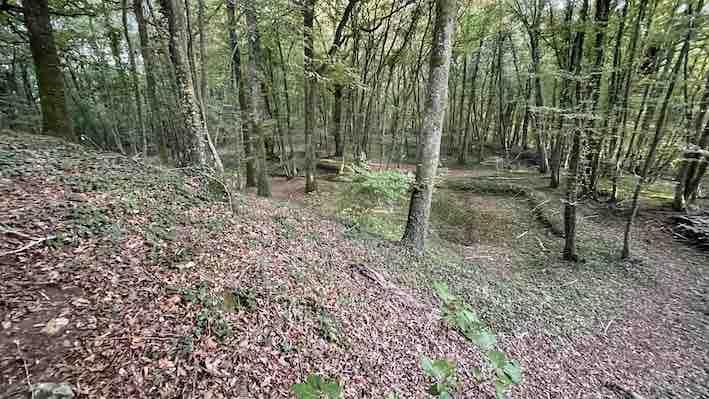
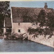
La Butte du Château (Castle Mound)

Distance and time : 15.5 km (4 hours 30)

To discover :
♦ The castle mound, known locally as 'La Butte du Château' on the edge of the Saussay forest appears as a raised mound constructed towards the middle of the 10th century.  Circled by deep ditches, the site comprises a platform with traces of a building and a watchtower, two outer baileys protected by earth ramparts and a parapet walkway. The entrance consists of a tower gateway.  Its original military use was replaced by residential occupation. BPN has placed an information panel on the site.

Motte castrale en forêt de Saussey

La motte castrale 1

La Butte du Château

La Butte du Château
15.5 km - 4 hours 30
Departure : Bretoncelles, car park of the 'Complexe Sportif'.
Direction: clockwise.
Waymarking : (PR) yellow signposts and way marks.
Ease of walking : quite good, some wet sections that need short detours into the undergrowth.
Terrain : dirt or stony paths and tarmac lanes (81%).

Points of interest : mostly forested circuit, presence of wild boar, archaeological site (castle mound).

Useful links:

  1. Route here;
  2. Map here;
  3. GPX file here.

La butte carte 1                  QR code map

Qr en butte itin                  QR code route

More information about the castle mound here.

Motte castrale de Bretoncelles

Motte castrale de Bretoncelles

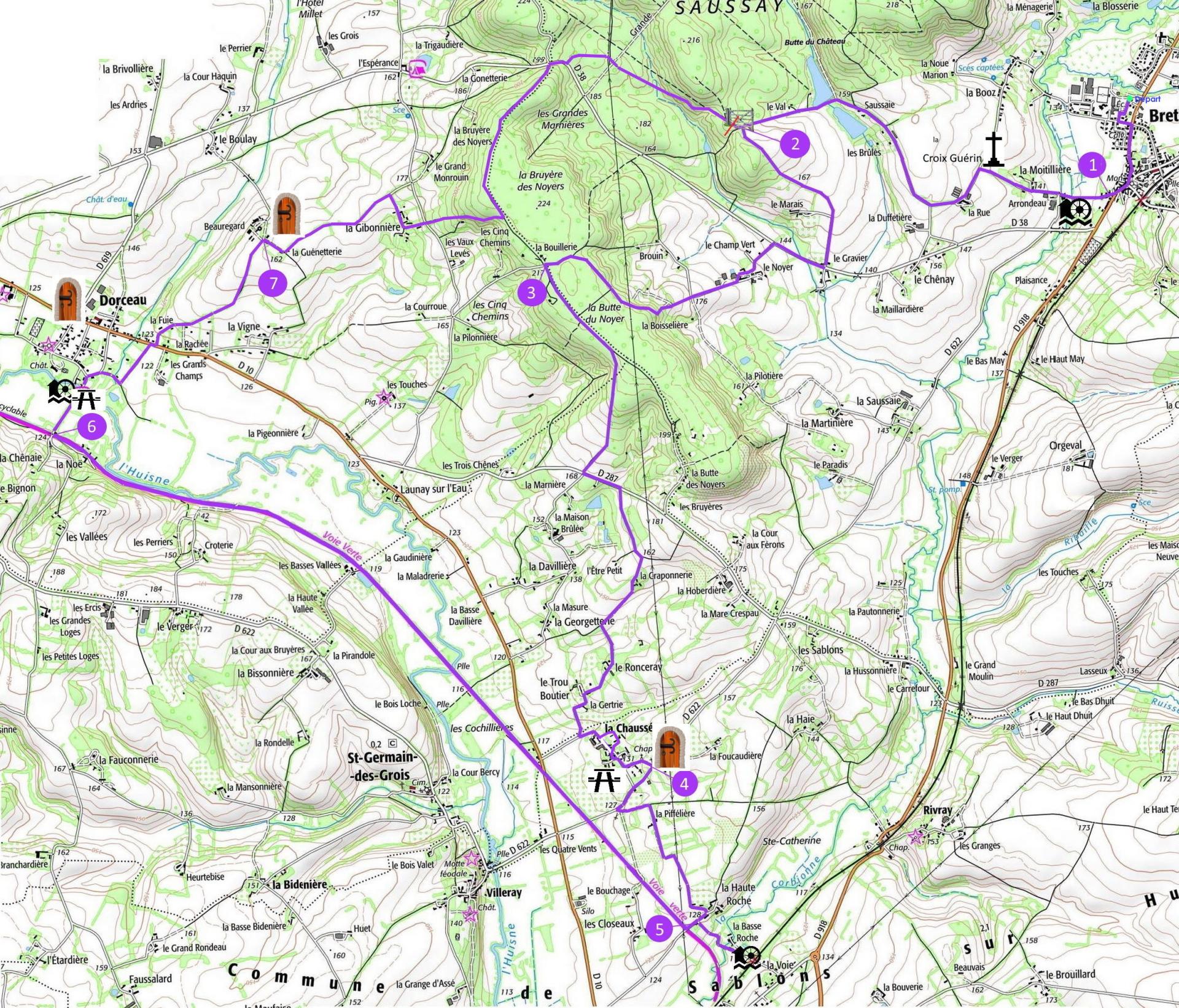
La Boucle des Trois Moulins (The Three Mills Circuit)

Distance and time : 26 km (7 hours)

To discover :
♦ La chapelle de la Chaussée : chapel of Our Lady of the Seven Sorrows of the Blessed Virgin Mary.
♦ The greenway (voie verte) : former railway from Condé-sur-Huisne to Mortagne.
♦ The round tower of Beauregard, a beautiful Perche farm.
♦ The mill of Dorceau.
♦ The mill of Arrondeau.
♦ The mill of Basse Roche.

La boucle des trois moulins carte modif 09 23

Chapelle la chaussee

Les 3 Moulins

Les 3 Moulins

Les 3 Moulins

Les 3 Moulins

Les 3 Moulins


Useful links:

  1. Route here;
  2. Map here;
  3. GPX file here.

Qr code boucle carte        QR code map

Qr en 3moulins itin       QR code route

Moulin d arrondeau vieille carte postale

Departure:  Bretoncelles, car park of the 'Complexe Sportif'.
Direction : clockwise.
Way marking: (PR) pyellow signposts and way marks.
Ease of walking : good.
Terrain : dirt or stony paths (72%).
Points of interest: circuit for experienced walkers, picturesque and varied, it brings together nature and heritage and a section of the greenway.

The 4 other trails departing from Bretoncelles and maintained by BPN are here :

Last edited: 03/04/2024